Reading the Land: Environmental Compliance Scouts and the Surveys That Define What Gets Built
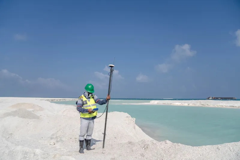
The question of what can be built on a given piece of American land is not answered by a zoning map. It is answered by the land itself — by what is living on it, what was buried in it, and what federal, state, and local regulations have to say about both. Environmental compliance specialists and site assessment professionals are the people who ask that question on behalf of developers, contractors, and public agencies before the process of obtaining permits begins.
Their work is field work in the most fundamental sense. It requires physical presence, direct observation, and the kind of contextual knowledge that cannot be acquired from a desktop database. It also requires an understanding of regulatory frameworks that is both broad and precise — because the consequences of getting it wrong fall not just on the project, but on the professionals who signed the assessment.
The Phase I Reality
Most development professionals are familiar with the Phase I Environmental Site Assessment — the standardized investigation that evaluates a property's history and identifies recognized environmental conditions that might indicate contamination. Phase I reports are a routine component of commercial real estate transactions, required by lenders and often by buyers themselves as a condition of due diligence.
What is less understood is the degree to which a Phase I assessment is only as good as the professional conducting it. The ASTM standard that governs Phase I assessments — E1527-21 — establishes a methodology, but methodology is not expertise. An environmental professional who has walked hundreds of former industrial properties in the Rust Belt develops a different quality of observation than one who has conducted assessments primarily from records reviews and site walk-throughs of undeveloped parcels.
Experienced environmental scouts describe learning to read a property's history from physical evidence that does not appear in any database. Discolored soil at the edge of a parking lot. A cluster of dead vegetation in an otherwise healthy field. The faint chemical odor near a drainage channel that no longer appears on any map. These are the signals that inform a Phase I recommendation to proceed to Phase II — and the professionals who catch them early save their clients from discoveries that are far more costly when made later.
Wetlands, Wildlife, and the Regulatory Maze
Contamination is only one of the environmental variables that site assessment specialists must evaluate. Wetlands determination is another, and it carries its own complexity. The jurisdictional reach of the Clean Water Act over wetlands has been the subject of ongoing legal interpretation, including significant Supreme Court decisions that have shifted the regulatory boundary multiple times in recent years. Environmental compliance professionals who work near waterways, in coastal regions, or on properties with seasonal water features must navigate this shifting landscape with a level of current knowledge that demands continuous professional development.
Wetlands delineation is a field skill. It requires walking the property boundary, examining soil composition, identifying hydrophytic vegetation, and documenting hydrology indicators — the physical evidence of water presence that determines whether a given area meets the regulatory definition of a wetland. The findings of a delineation survey can add acres to a developable footprint or subtract them, and the difference can determine whether a project is financially viable.
Endangered species and critical habitat surveys add another layer. The Endangered Species Act imposes significant constraints on development that affects listed species or the habitat they depend on. Pre-project surveys — conducted by biologists and environmental specialists who know what to look for and when to look for it, since many species assessments must be conducted during specific seasonal windows — provide the documentation that regulatory agencies require and, more importantly, the advance warning that allows developers to adjust site plans before they are committed to a design that cannot be permitted.
Local Knowledge as Competitive Advantage
The environmental compliance professionals who consistently deliver the most useful assessments are those who combine technical expertise with deep local knowledge. They know which state agencies have particular sensitivities around certain habitat types. They know which municipal planning departments have historically interpreted wetland buffers conservatively, and which have been more permissive. They know the history of industrial use in a region well enough to anticipate contamination risks that a national database would not flag.
This local knowledge is not incidental. It is a primary driver of value. A national development firm entering an unfamiliar market that retains a locally experienced environmental compliance scout is not just purchasing a report — it is purchasing a form of regulatory intelligence that can compress the permitting timeline significantly.
In competitive development markets, timeline compression is a financial variable. A project that moves from site control to permit issuance in eight months rather than fourteen has a materially different cost structure than one that stalls in regulatory review. Environmental compliance specialists who understand the local regulatory environment well enough to anticipate objections, structure assessments that pre-answer agency questions, and maintain working relationships with the staff who review permit applications are delivering value that extends well beyond the documentation they produce.
The Scout's Eye View
Environmental compliance scouts occupy an unusual professional position. They are simultaneously technical specialists, regulatory navigators, and field professionals whose primary instrument is their own trained perception. They work alone or in small teams, often in remote or undeveloped areas, and they are frequently the first professionals to set foot on a site that may eventually support a hospital, a distribution center, a residential community, or a renewable energy installation.
That first-contact perspective carries a kind of responsibility that the professionals in this field tend to take seriously. What they document — and what they recommend — shapes every subsequent decision about a piece of land. A missed wetland boundary, an unidentified contamination indicator, or an overlooked habitat feature can generate regulatory complications that persist for years and cost multiples of what the assessment itself cost to conduct.
Conversely, a thorough and well-documented pre-project assessment can transform a site that appears problematic on paper into a developable asset. Environmental compliance is frequently framed as a constraint — a set of requirements that slow projects down and add cost. The professionals who conduct rigorous field assessments understand it differently. They see the regulatory landscape not as an obstacle but as a terrain feature, one that can be mapped, understood, and navigated by anyone with the expertise and the willingness to walk the ground before the permits are filed.